Bishopsgate
Bishopsgate, City of London
A former Roman road and now the City of London’s highest rising street, with office towers clustered around its southern half

Bishopsgate runs north from Gracechurch Street to Norton Folgate. The gate in the city wall was called ‘Porta Episcopi’ in Domesday Book, and this was anglicised as Bishopsgate by the 12th century. It is said that the name refers to Saint Erkenwald, who was Bishop of London for eleven years in the late seventh century.
Houses began to appear on both sides of the gate in the 13th century and by the 16th century the whole road was lined with buildings, including the merchants’ residences of Crosby Place and Gresham House and the churches of St Botolph, St Helen and St Ethelburga.
Like many of the gates in the City wall, Bishopsgate was demolished in 1761. Continuous rebuilding has left nothing of the medieval street except for the core fabric of the surviving churches.
Shoreditch station opened in 1840 to serve as the London terminus of the Eastern Counties Railway. It was renamed Bishopsgate in 1847 and was replaced by Liverpool Street station in 1874, after which the old terminus was converted to a goods station. Shoreditch High Street station now occupies its site (which is beyond the top of the map below).
The most pleasing remnants of the Victorian era are Dirty Dick’s pub (which is not as dirty as it used to be) and the edifying Bishopsgate Institute, both near Petticoat Lane. Crosby Place’s great hall survived until 1908, when, threatened by the prospect of demolition, it was taken down and rebuilt on Cheyne Walk in Chelsea.
Since the 1960s the construction of a succession of office blocks and towers has made Bishopsgate one of the City’s most unashamedly commercial thoroughfares.
At its northern end the Broadgate complex borders the street’s west side. The NatWest Tower was completed on the site of the former Gresham House in 1981, when it was Britain’s tallest building. A bird’s eye view reveals the tower to be designed in the shape of the National Westminster Bank’s symbol: three intersecting chevrons forming a chopped-cornered triangle. The bank moved out in the early 1990s and the building has been renamed Tower 42.
In 1993 a massive IRA truck bomb killed a freelance photographer and caused £350 million worth of damage when it exploded outside 99 Bishopsgate. This marked the culmination of a terrorist campaign against City targets, prompting the Corporation of London to create the so-called ‘ring of steel’ that reduced access to the central part of the City and placed police checkpoints on the remaining routes.
East of Bishopsgate the building formally called 30 St Mary Axe was completed in 2004 on the site of the Baltic Exchange, which had been the victim of another IRA bomb. This bulbous tower is commonly known as ‘the Gherkin’.
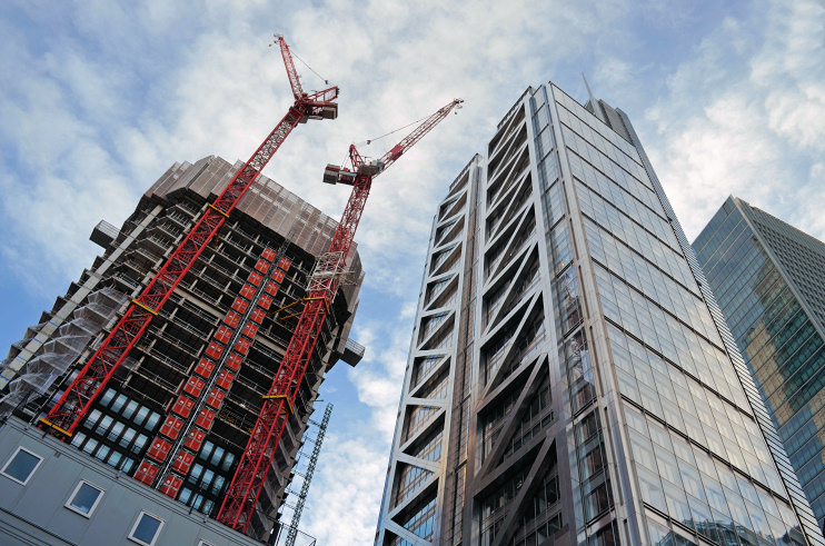
In 2011 Bishopsgate acquired the City of London’s latest tallest building, Heron Tower (110 Bishopsgate). Its roof height was soon exceeded by that of the Cheesegrater, but Heron Tower’s 28-metre spire permitted it to maintain an air of superiority. The tower is shown in the photo at the top of this article, with the under-construction One Bishopsgate Plaza to its left.
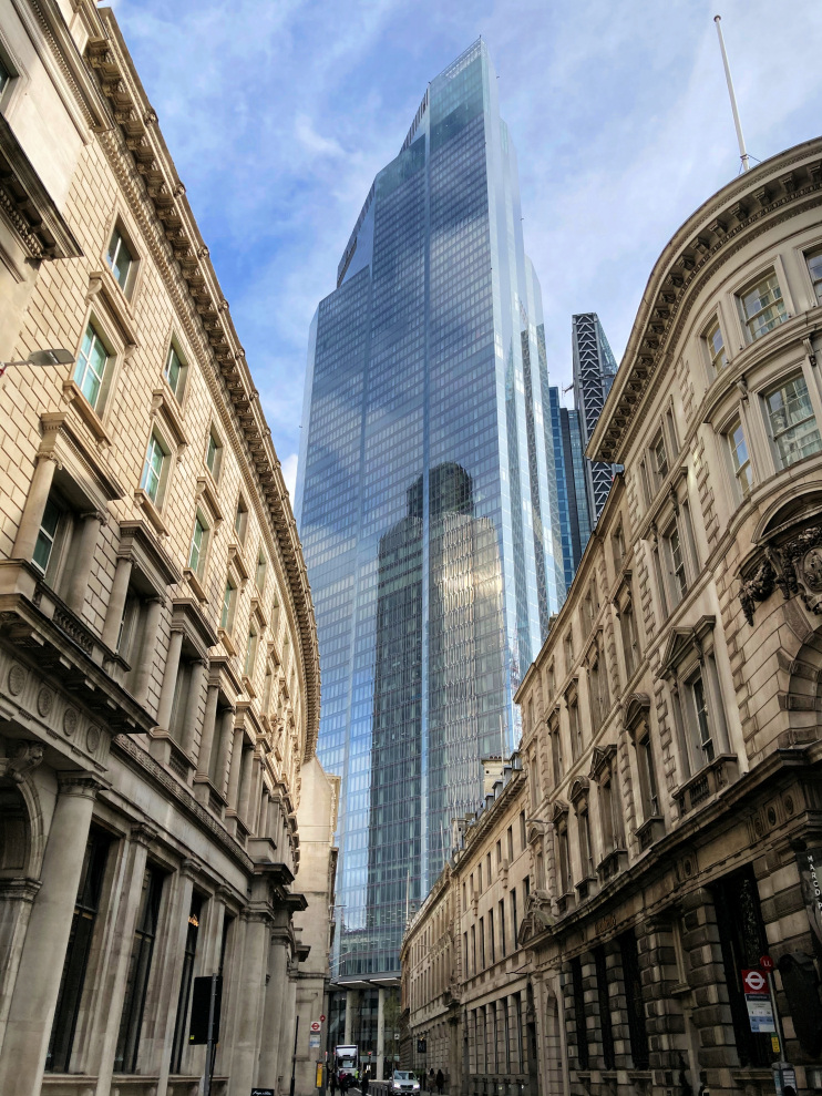
Since it topped out in May 2019, a 62-storey tiered tower at 22 Bishopsgate has been the City’s undisputed tallest building and second only to the Shard in London as a whole. ‘Twentytwo’ (as it was earlier called, though ‘22’ now seems to be preferred) was completed in 2020 and is shown in the photo below, which was taken on 20 October 2020.

A tax record for 1596 notes that William Shakespeare was lodging in the parish of St Helen’s, Bishopsgate. There is no confirmation that this was the Bard himself – but it probably was. In 2019 theatre historian Geoffrey Marsh claimed to have pinpointed the exact location: a house overlooking St Helen’s churchyard. Shakespeare was familiar with Crosby Place and used it as the setting for Gloucester’s plotting in Richard III.
Postal districts: EC2 and E1
Population: 222 (2011 census)
