Farnborough
Farnborough, Bromley
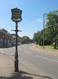
A suburban village situated on the edge of larch woods and open country, at the south-western extremity of Orpington’s sprawl

In 862 an Anglo-Saxon charter describing the bounds of Bromley identified Fearnbiorginga mearc – ‘the boundary of the people of Farnborough’. The place’s name derived from the Old English words fearn and beorg, referring to a small hill overgrown with ferns. It was written as Ferenberga in 1180 and Farnberg in 1226. In Fearnbiorginga the -inga part meant ‘dwellers at’.
The manor of Farnborough belonged to the Duchy of Lancaster “from the first erection of it,” as Edward Hasted put it in his History of Kent (1797). The powerful Simon de Montfort leased Farnborough Hall to Simon de Chelsfield in the mid-13th century.
In 1639 a great storm destroyed the church of St Giles the Abbot, which had to be rebuilt from scratch. Vestry records depict an active community in the 18th century, with plenty of takers for rewards that were offered for badgers’ heads and the carcasses of foxes, polecats and hedgehogs.
In 1845 Bromley board of guardians built a union workhouse at Locksbottom. It subsequently evolved into Farnborough hospital, now Princess Royal university hospital, which is part of King’s College hospital foundation trust.
Like Downe and Green Street Green, Farnborough was popular with walkers and cyclists in the early 20th century and refreshment rooms abounded.
The pretty village began to succumb to suburban development after the First World War, bringing about the fragmentation of the area’s long-established Gypsy community. When Urania Boswell, the queen of Kent’s Gypsies, died in 1933 a crowd of 15,000 turned out to watch her funeral procession. Also known as Gypsy Lee, she was buried in St Giles’ churchyard.
After the Second World War the area north of the High Street filled with housing, but green-belt legislation prevented building further south. The developments included Darrick Wood, which is now Keniston Housing Association’s largest estate, with around 360 houses and flats, and sheltered accommodation for the elderly.
The Farnborough and Crofton ward has an above-average proportion of older people and the vast majority of residents are white. At Farnborough primary school very few pupils are from minority ethnic groups and a very small number are at the early stages of learning English. The school has been an academy within the Nexus Education Schools Trust since 2015.