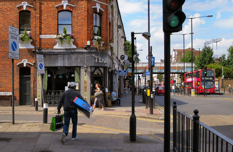
Green Lanes
Green Lanes, Hackney/Haringey/Enfield
One of London’s longest stretches of road with a single name, Green Lanes runs from Newington Green to Bush Hill

This was part of an ancient route that led from London’s Shoreditch through Enfield to Hertford, and may have been in use from the second century ad.
The road connected a series of greens, most of which have since been lost, even in name. Among these were Beans Green at present-day Manor House, Ducketts Green, and Elses Green, which lay at what is now the junction of Wood Green’s High Road and Lordship Lane.
Drovers bringing animals to London for slaughter liked the road because it was less busy than other highways.
It was formerly called Green Lanes for an even greater length than its present extent, but in the mid-19th century the southernmost part was renamed Southgate Road, and the section that passes through Wood Green became the High Street, which was changed to High Road around 1895.
This was a time when developers were laying out a series of middle-class streets in Green Lanes’ Harringay hinterland (which is the focus of the map below) and the main road was lined with long, imposing shopping parades.
Over the first half of the 20th century the Harringay area declined in social status and many houses were subdivided, making property affordable to Turkish immigrants who arrived from Cyprus from the late 1950s onwards. A snowball effect strengthened the community here and the eastern Mediterranean ambience of the shops and cafés later drew Greek Cypriots too.
Despite the intercommunal tensions and occasional violence on their native island, the two communities lived in harmony – and in 1981 the magazine New Society called Green Lanes the ‘spinal chord’ of Cypriot London. Many Greek Cypriots have since moved further north, although some continue to operate or work in businesses here.
The Turkish Cypriots have increasingly been joined by compatriots from mainland Turkey, and more recently by Kurds and Bulgarians. These ethnic groups also have a history of rivalry with the Turks but co-existence was peaceful on Green Lanes until conflict arose between Turkish and Kurdish gangs over drugs territory. In a mass street fight in 2002, four men were shot and another was stabbed to death. The stresses caused by this incident have mostly been resolved since as the communities strive to prove that the majority of their number are hardworking and respectable.
Other south-eastern European minorities represented on Green Lanes include Kosovans and Albanians.
Sections of Green Lanes have recently begun to take on a more gentrified, non-ethnically-specific aspect, primarily in the form of some stylish cafés and bars.
The area’s harmonious fusion of Greek and Turkish Cypriots has been the subject of frequent media attention, including a 2001 BBC radio documentary entitled Green Lines, Green Lanes.
