Higham Hill
Higham Hill, Waltham Forest
The disadvantaged north-western part of Walthamstow

Saxons made a clearing in the forest here and the manor of Higham is recorded in Domesday Book. The original Higham House was located here, near present-day Sutton Road. The house was subsequently rebuilt in the far east of the manor, facing Woodford Green.
The manor went through several subdivisions and reunifications and this part was later called Higham Benstead. It was in the hands of the Heron family for many years but was at one point seized by the crown because of a marriage to the daughter of the ‘traitorous’ Sir Thomas More. The hill itself was common land with grazing rights permitted to local parishioners.
A bridge across the River Lea was said to have been in existence in 1594, when a moderately large hamlet had evolved. The population then went into a decline until the enclosure of the common in 1850, which led to some tentative suburban development in the 1870s.
By the end of the 19th century parts of Higham Hill had been densely built up, and some of the housing became overcrowded.
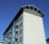
Walthamstow council began the first of its many slum clearance and rebuilding projects here after the First World War, in Millfield Avenue. Among the other schemes were the Higham Hill estate of 1920 and Priory Court, begun in 1946 and subsequently rebuilt.
Successive phases of redevelopment brought tower blocks in the 1960s and 1970s and large sums were spent on neighbourhood renewal programmes in the period before austerity.
Unemployment levels are relatively high, while the largest proportion of men and women work in wholesale, retail and car repair activities. Around half of residents rent their homes, most from the council. Islam is the second most predominant faith after Christianity.
According to the website/blog London Street Gangs, Higham Hill is known locally as Grimehill and its dominant youth gang has for some while been the Priory Court Boys (or some renamed incarnation of the same outfit).