Sewardstone
Sewardstone, Epping Forest, Essex
Sewardstone and Sewardstonebury are the only places on Hidden London that lie beyond the boundary of Greater London – and they are included because they fall within the E4 London postal district

The discovery of a dug-out oak canoe indicates the possibility of an Iron Age settlement here. The village’s name derives from ‘Seward’s ton (farmstead)’.
The manor of Sewardstone occupied the southern part of the parish of Waltham Holy Cross and it was first recorded in 1177, when Henry II made a grant of land here to the canons of Waltham Abbey. The manor held its own courts from the 13th century. The hamlet lay on the old route to the abbey from Chapel End in Walthamstow and one of the earliest recorded dwellings here was the Pentensary, which was the home of the abbey’s pittancer. A pittancer’s job was to distribute pittances, which were originally pious bequests made to religious houses.
Other properties standing here in the late 17th century included the Netherhouse in Sewardstone Road and Carrolls at Sewardstone Green, which are both recalled in the names of present-day farms. In 1674 the manor was purchased by James Sotheby, who was a noted antiquarian and book collector, although not apparently connected with the auctioneers of the same name. His son William Sotheby was a translator of the classics and a poet. The manor remained in the hands of the Sotheby family for over 200 years.
There was a silk factory here in 1806, to which poor boys and girls were sent from Enfield’s Chase Side workhouse. By 1813 Chingford post office was delivering mail to Sewardstone, which was the origin of its inclusion in the E4 postal district. Waltham school board built a primary school here in 1874 but this closed in 1939, after which children had to travel to a new school in Yardley Lane.
In addition to its farms and some desirable residential properties, Sewardstone is adorned by a string of nurseries (of the horticultural kind) in the northern half of the village, both retail and wholesale, including Northfields and Beechside.
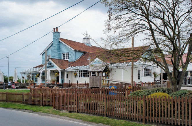
Shown in the photograph at the top of the page,* the Plough public house is located at the corner of Sewardstone Road and Mott Street, at the extreme northern end of the E4 postal district. (Click here to see the pub’s location, and the postal district boundary, on Streetmap.) The Plough has been a McMullen pub since 1917 and was rebuilt in 1980.
The Sewardstone Marsh nature reserve is part of the Lee Valley regional park. The park authority also runs a campsite nearby and describes the marsh as “real gem and quite a rarity in modern Britain – a wetland habitat where you can enjoy discovering thriving populations of amazing animals and plants.” It is also popular with birdwatchers and is traversed by section 18 of the London Loop. Godwin Close, off Sewardstone Road, provides access to the marsh.
Postal district: E4
Web page: Diamond Geezer walks the London Loop through Sewardstone
