Clockhouse, Sutton
Clockhouse, Sutton
An anomalous enclave occupying a peninsula of the London Borough of Sutton, isolated from the rest of the borough by fields and golf courses but joined up with Coulsdon, further to the south-east

This was formerly the open land of Clockhouse (or Clock House) Farm, which was associated with the village of Woodmansterne and had eight cottages in the 19th century.
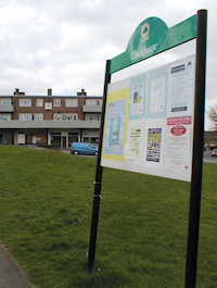
Developers put up semi-detached houses here following the opening of Woodmansterne station in 1932 and Carshalton council built the Clockhouse estate before and after the Second World War, with local shops at Hillcrest Parade on the Mount. Locals often refer to the Clockhouse area as ‘the Mount’, after this central road, which is shown in the photo above.* Privately-built detached houses and council flats and maisonettes later extended the diversity.
The clock-topped farmhouse that gave the estate its name lay across the Surrey border in Banstead and was demolished in the 1970s to make way for more houses. Among the most recent additions are housing association properties next to the Methodist church on Whitethorn Avenue. Since a boundary change in 1993 Sutton council has operated the sport and recreation facilities at Corrigan Avenue.
Located at the eastern end of Longlands Avenue, the almost rural Jack & Jill pub closed without notice in May 2018. At the time of writing it is not known whether it will reopen.
The only direct way to reach Sutton town centre is to walk (or of course ride a horse) along bridlepaths. Most young residents of Clockhouse are educated within the borough of Croydon, but local voters have overwhelmingly rejected the opportunity to secede from Sutton.
Clockhouse formerly had the lowest population of any ward in all the London boroughs but has since been amalgamated with parts of Carshalton.
A 2004 attempt to use census data to measure happiness found that the ward of Carshalton South and Clockhouse was the second ‘happiest place to live’ in London.
Postcode area: Coulsdon CR5
Population: 9,715 (Carshalton South and Clockhouse ward, 2011 census)