Kennington
Kennington, Lambeth/Southwark
A diverse district of terraced townhouses and tower blocks situated east of Vauxhall

First recorded in Domesday Book as Chenintune, the name probably meant ‘the farm of a man called Cēna’, although others have suggested ‘place of the king’.
In 1337 Kennington was given to Edward, the Black Prince, and a royal palace was built here. Though the palace has long gone, the manor has belonged to the eldest son of England’s monarchs ever since as part of the Duchy of Cornwall. From 1622 the duchy started to grant leases to Kennington’s residents, giving them an incentive to improve their properties. The construction of Westminster Bridge in 1750 brought accessibility and early popularity as a place of residence.
Most of the modern layout of Kennington was set by 1799, although the south-western part, including Kennington Oval, developed a little later. By 1818 the present street pattern was fully established and the village was becoming a semi-rural suburb with grand terraced houses of four or even five storeys.
Kennington Common was a venue for fairs and executions; St Mark’s church stands on the site of the gallows. In 1848 a huge crowd assembled on the common intending to march on Parliament to present its Chartist petition. The march was banned and the crowd was persuaded by the Chartist leader Feargus O’Connor MP to disperse peacefully.
In 1852 the common was converted to “a pleasant place of recreation” and renamed Kennington Park. This was at a time of increasingly dense building all around – and older villas were succumbing to multiple occupation. Karl Marx wrote in Das Kapital that Kennington was “very seriously over-populated in 1859, when diphtheria appeared.”
Kennington station opened on the Bank branch of the Northern Line (originally called the City of London and Southwark Subway) in 1890 and served the Charing Cross branch also from 1926. Tram and bus routes also converged here; Kennington was described in the 1920s as “the Clapham Junction of the southern roads” and St Mark’s became the tramwayman’s church.
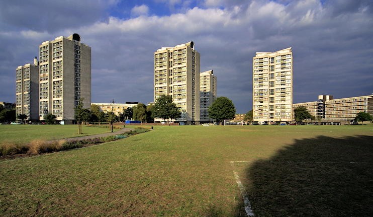
Lambeth council built all kinds of municipal housing here from the early 1950s to the late 1970s, including several high-rise estates. East of Kennington Park, the London County Council’s Brandon estate (shown in the photograph above) was their first such project to retain some existing terraces. Kennington’s long decline is now being reversed as the advantages of its location prompt the reuniting of formerly subdivided properties.
Occupying part of the former Lambeth Workhouse, at 2 Dugard Way, off Renfrew Road, the Cinema Museum is one of London’s view-by-appointment-only collections. It also hosts programmes of ticketed events.
Kennington was the birthplace in 1887 of Bernard Montgomery, later Field Marshal Viscount Montgomery of Alamein.
Postal districts: SE11, SE17, SW8 and SW9
Population: 15,106 (Oval ward, 2011 census – a 26 per cent increase on 2001)
Station: Northern line (zone 2)
Further reading: Jill Dunman, Lambeth, Kennington and Clapham, Sutton, 1999
and Edward Walford, Walford’s History of Stockwell and Kennington, ed. John W Brown, Local History Reprints, 1996
Website: Vauxhall, Kennington and the Oval
