Marsh Side
Marsh Side, Enfield
A rarely used name for the eastern edge of Lower Edmonton, focused around the northern end of Montagu Road

Marsh Side was earlier known as Jeremy’s Green or, more curiously, John a Marsh Green. The Marshes were a family of Norman origin who took a new surname from Edmonton Marsh, where they lived from the 13th century. John Marsh died around 1312 and divided his lands among four sons and two daughters in his will. It is therefore possible that Marsh Side gained its name because this was the Marsh family’s side of Edmonton, rather than on account of the undeniably boggy terrain.
There were cottages and an inn here around 1600, surrounded by farmland. The inn was called the Cart Overthrown by 1752. In 1801 Marsh Side had 31 dwellings, including neighbouring farmhouses.
Marsh Side at last showed signs of growth from the mid-19th century as Edmonton began to expand in all directions. Baptists established a chapel here around 1890 but the congregation must have proved unsatisfactory as it closed after barely five years. Industry and a sewage works filled most of the former farmland east of Montagu Road (which was earlier called Jeremy’s Green Lane and later renamed after the banker and philanthropist Samuel Montagu) during the first half of the 20th century, while housing was built to the west.
The area was left heavily cratered by Second World War bombing and never recovered its earlier vitality. In 1949 Edmonton borough council decided to create the Claverings industrial estate on the site of a farm of that name, which had been in existence since the 14th century. Factories were built here in the 1950s and early 1960s but – as with most London industrial estates – it’s now more of a (small) business park.
Enfield council (the successor to Edmonton) built the 22-storey Walbrook House near the eastern end of Bounces Road in 1967–8. The construction alongside the railway line of Meridian Way in the early 1990s helped to regenerate industrial and commercial life in the area, at least for a while.
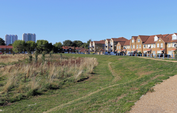
In 2002 Laing Homes laid out an estate to the east of Montagu Road on the site of former allotments, with properties ranging from one-bedroom flats to five-bedroom houses. Some of the housing (on Zambezie Drive) is shown in the photograph at the top, together with recently completed improvements to flood prevention landscaping beside Salmon’s Brook.
The Cart Overthrown closed in January 2017, probably for good. The pub had been rebuilt in the 1930s and was latterly just called the Cart.
At the last census, the locality’s main ethnic group was white British, followed by people of black African, black Caribbean and Turkish heritage. Around two-thirds of residents were born in the UK.

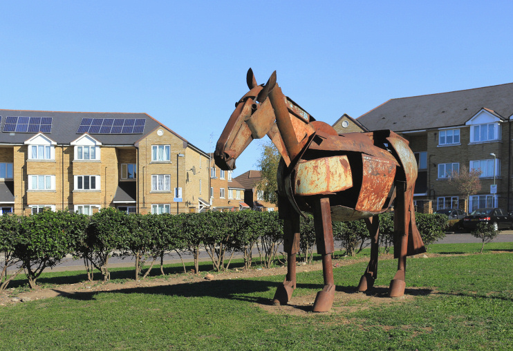
Shown in the photo above, Monty the metal horse is an installation at Chad Crescent, commissioned in 2003 by the London & Quadrant Housing Trust and the Metropolitan Housing Trust to mark their 40th birthdays. Made from recycled materials, Monty is the work of the sculptor Iain Nutting.
