Woodford
Woodford, Redbridge
‘The geographical and social high point of east London’, situated to the north-east of Walthamstow, from which it is separated by a sliver of Epping Forest

Woodford’s existence was first recorded in 1062 and it takes its name from a woodland ford across the River Roding, which was located at present-day Woodford Bridge. Like Chingford to the north-west, the district was for centuries a collection of separate hamlets in forest clearings.
Even before the Restoration, wealthy Londoners had begun to build grand houses here, and others later rented rooms for the summer. In the mid-18th century these rooms were said to be more expensive than in the capital itself. By the time Woodford was deforested in the early 19th century there were so many mansions with large gardens that there was hardly any room for agriculture.
Several grand houses survive from Woodford’s heyday, including the glorious Hurst House (c.1714) at the south end of Woodford Green, Elmhurst (perhaps 1760s), on the South Woodford side of St Mary’s, and Woodford Bridge’s Gwynne House (1816, later a Barnardo’s home and now the ridiculously named London Chigwell Prince Regent Hotel, BW Signature Collection).
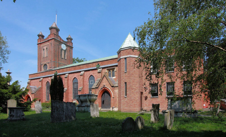
Before the opening of the station in 1856 Woodford was centred on the Church End locality – the vicinity of St Mary’s church, which was founded here in the 12th century. The present-day church is shown in the photo below.
In addition to St Mary’s, Woodford has three other architecturally notable churches: St Paul’s Woodford Bridge (1854), All Saints Woodford Wells (1874) and Woodford Green United Free Church (1904).
The coming of the East Counties Railway brought suburban development, but not of the densely terraced kind so common elsewhere, because the railway company did not offer cheap fares for workmen. The council also conspired to keep out the lower classes by refusing to permit tram services here.
The British Land Company bought the Woodford Hall estate in 1869 and laid out new roads west of the church. A series of similar developments in the grounds of old houses followed over the next 60 years and almost the whole of modern Woodford was built up by the outbreak of the Second World War.
The privately developed estates were often of the highest quality, especially in the west. More affordable properties were built in South Woodford and east of the railway line, together with some post-war council estates, the largest of which is Broadmead, completed in 1968.
The central part of Woodford has two main shopping streets: Snakes Lane, which is split in two by the railway, and Broadmead Road. The Broadway, with its curved terraces of attractively detailed three-storey shops nuzzling up to the station, is now one of Woodford’s many conservation areas.
Further east, Ray Park was formerly the grounds of the 17th-century Ray House. Ironically, negotiations for its purchase by Bryant and May were abruptly halted when the house was devastated by fire. The company used the grounds as a sports facility in the middle decades of the 20th century. Ray Park now offers a variety of activities for families, with facilities that were enhanced in 2009-10.
St Mary’s church was also devastated by fire, in this case caused by arson in February 1969. The interior and east front were afterwards reconstructed.
By London standards, Woodford is an ethnically homogenous suburb. More than 60 per cent of residents are white British and no other ethnic group accounts for more than 10 per cent of the total. After English, the most widely spoken languages are Polish, Urdu, Lithuanian, Gujarati and Turkish, but each of these is spoken by fewer than one per cent of residents. Living standards are high across Woodford, especially in the north and west of the district.