Map key
Map key
A key to the maps shown at the bottom of most gazetteer pages
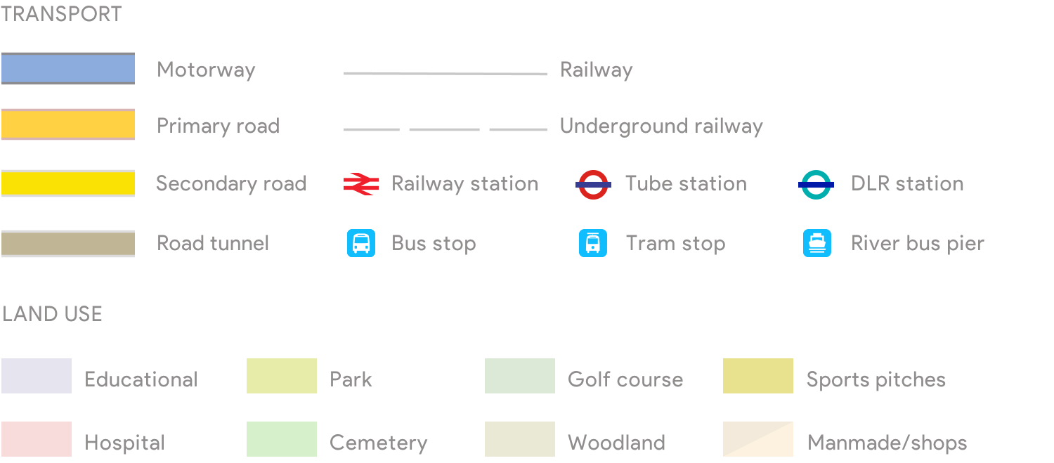
Some hues vary according to degree of zoom
Land use colours should be treated as a rule of thumb rather than a certainty
River bus piers and (especially) bus stops appear only in high zoom views – as do secondary entrances to DLR stations
An example map is shown below – and you’ll instantly detect why I chose this area. It’s rare to see so many parcels of land given over to different categories of usage in close proximity to one another, which makes it an atypically colourful specimen of London cartography.
Like all the Google maps on Hidden London you can zoom in or out using the plus and minus buttons; drag the person icon to almost any road for a Street View; and move the whole map around to show any part of London (or beyond).
Click ‘Satellite’ for a bird’s-eye view. Click ‘Map’ for standard Google maps colouring.
NB The site presently has more non-Google maps than it used to have. This is primarily an expedient to avoid Google’s prohibitively expensive charges for high usage.