Malden Rushett
Malden Rushett, Kingston upon Thames
A crossroads hamlet situated south of Chessington World of Adventures in the southernmost part of the ‘tongue’ of the borough that protrudes into the Surrey woodland

Eleventh-century Malden rambled across two manors, one of which has since become Malden Rushett – a reference to the rushes that grew here. The manor was heavily wooded at the time of Domesday Book and remained so for several hundred years. Sixty Acre Wood is a surviving part of the ancient woodland. Cultivation in the 17th century made use of a technique known as devonshiring, or denshiring – paring off old turf, burning it and spreading the ashes on the land.
Malden Rushett, also known as Lower Malden, Lower Chessington or ‘the Rushett’, remained part of Malden parish until 1884 when it transferred to Chessington. Until then residents of the hamlet’s cottages had to go to (Old) Malden to be married, although they could be buried in Chessington. Some years later a temporary corrugated mission house known as an ‘iron church’ was erected with room for sixty cottagers, and ‘improving’ lectures were given here.
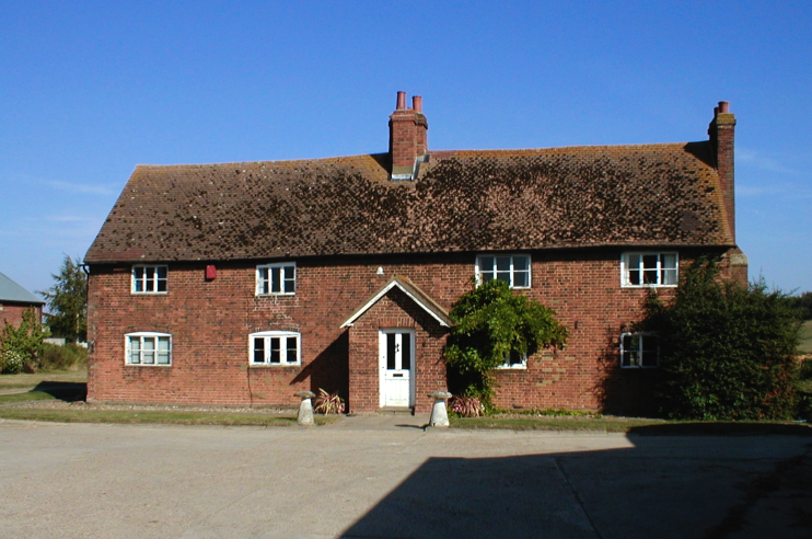
In the 1930s the Southern Railway Company planned to extend the Chessington branch line to Leatherhead, with ribbon development along the route and a sizeable town with its own station, probably built at Malden Rushett. The proposal was stymied by the outbreak of the Second World War and then by post-war designation of the area as green belt. A plan to locate an airport at Byhurst Farm also came to nothing, but Rushett Farm (18th-century farmhouse shown above) has a turf airstrip and a hangar for light aircraft.
Located at 423 Leatherhead Road (near the centre of the map below), the Shy Horse pub was previously called the Fox and Hounds. An inn of that name was in existence here by the late 19th century but the present building appears to date from no earlier than the 1930s.
Telegraph Hill is in the extreme south of the borough – and is its highest point, at 240 feet. Like other hills of the same name it was a beacon point for the navy’s semaphore system, relaying messages from the admirals in London to the fleet at Portsmouth.
Postcode area: Chessington, KT9
Blog post: Diamond Geezer visits Telegraph Hill
