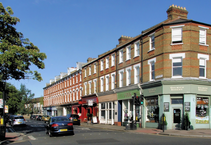
West Dulwich
West Dulwich, Lambeth/Southwark
A Victorian and Edwardian railway suburb bordering Dulwich, Tulse Hill and West Norwood

Although some believe that the locality is an estate agents’ invention, West Dilwysh was first recorded in 1344.
Hesitant growth began here after the opening of Dulwich station in 1863 (it did not become West Dulwich until 1926). The railway company laid out Thurlow Park, Rosendale and Turney Roads to provide access to the station, although these were at first unsurfaced. Building frontages were advertised but take-up was slow.
Rosendale Road’s eventual width and grandeur was supposedly the consequence of a plan to make it part of a grand processional route to the Crystal Palace. A speculator attempted to profit from this by laying out Tritton Road in its path, hoping to be bought out, but his bluff was called and the scheme was abandoned.
All Saints church was built in 1891. A spectacular structure for such a modest suburb, it is deservedly grade I listed.
The first houses in West Dulwich were very select, but properties became progressively more affordable as development spread westward. The main phase of construction came in the years before the First World War, although gaps were still being filled in the 1930s.
The area suffered badly in the Second World War. West Dulwich Congregational church, which stood on Chancellor Road (now Grove), was wiped out by a direct bomb strike in 1940. All Saints was damaged but subsequently restored.
Five V1 rockets fell on West Dulwich in 1944, prompting a post-war reconstruction programme that included the creation of the Rosendale Road estate.
In 1999 the unlucky All Saints church was gutted by a fire caused by a fan heater that had been left on overnight. An extensive renovation programme has since restored the exterior and improved the interior.
Pop funsters the Bonzo Dog Doo Dah Band first came together at 164A Rosendale Road, in 1962.
