Woodlands
Woodlands, Hounslow
A triangular-shaped group of tree-lined streets in west Isleworth, bounded by the Duke of Northumberland’s river to the east, the railway to the west and Worton and Bridge Roads to the south

Woodlands’ name was first recorded in 1485 and refers to arable strips of land beside a wood. Until the early 19th century the only structures on what was then known as Hounslow Field were some farm buildings and a moated house, both near the southern extremity of the modern locality.
The land was enclosed in 1818 and most of it went to the duke of Northumberland. Enclosure came relatively late here, probably because the soil was already being worked efficiently and intensively by the many market gardens.
The arrival of the Hounslow loop railway in 1850 brought the first suburban villas to the northern tip of the triangle, in what the Victoria County History calls “a slightly humbler version of Spring Grove.” Building plots were divided by substantial yellow brick walls, many of which still survive to show the former pattern of field division.
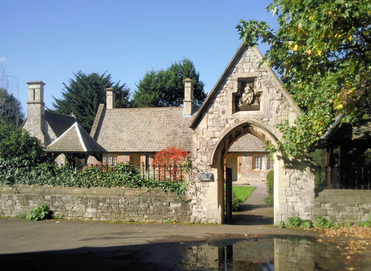
St John’s Church (shown in the photograph at the top) and the Woodlands Tavern served the Woodlanders’ spiritual and temporal needs. Shown in the photo below, Farnell’s almshouses were built behind the church in 1858.
Stimulated by the development of the Great West Road, the southerly expansion of Woodlands accelerated after 1925 with the construction of the Warren estate, named after developer RT Warren, a local builder. Houses and bungalows were built, first along existing thoroughfares and then on newly laid out streets, with a central plot that was later bought by the residents’ association for use as a park and recreation ground. The council facilitated mortgages for would-be residents in an early encouragement of owner occupation.
The last phase of Woodlands’ original development came after the Second World War, with the building up of Bridge Road and Worton Road, the creation of Gibson Close and the opening of Oaklands school on Woodlands Road (earlier called Hounslow Field Road). Oaklands now caters exclusively for 11- to 19-year-olds with severe learning difficulties, profound or multiple learning difficulties and autistic spectrum disorders.
The residents’ association built a new pavilion in the park in 1973. The Victorian part of Woodlands was designated a conservation area in 1999.