Ruxley
Ruxley, Bexley/Bromley
A predominantly rural area with some light industry beside the main roads, situated immediately east of Foots Cray; the terrain rises further east to around 100 feet above sea level at Upper Ruxley, on the Kent border

This was Rochelei in Domesday Book, and the name may have indicated a place frequented by rooks. In the Middle Ages Ruxley was the centre of an administrative district – known as a hundred – extending as far as Hawley’s Corner, which is now on the southernmost edge of Greater London.
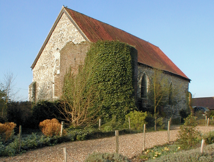
A small and basic parish church was built in the early 14th century and dedicated to St Botolph. It survives (barely) as a barn at Ruxley Manor, which is now home to a garden centre that Diamond Geezer calls a ‘Total Leisureware Nexus’.
The parish was combined with that of St James, North Cray, in 1557. The village of Ruxley is said to have been abandoned at that time, possibly as a result of bubonic plague.
Ruxley gravel pits were dug from 1929 to 1951 and now constitute one of London’s few areas of relatively undisturbed water south of the Thames. The River Cray flows through three of the pits and a fourth is fed by springs. The surrounding swamp and fen vegetation supports a remarkable diversity of birds, butterflies, dragonflies and beetles. Access is only possible by prior arrangement with the warden.
South-west of Ruxley Corner, Austrian manufacturer Richard Klinger built a factory and offices on Edgington Way in 1937, making gaskets and other sealing products here for the next 60 years. The building was designed by Wallis Gilbert and Partners, creators of west London’s wondrous Hoover factory. The frontage is now all that survives of the former factory and it is grade II listed.
