South Woodford
South Woodford, Redbridge
A separate community rather than just the southern part of Woodford, situated north of Snaresbrook

The northern part of this locality evolved much earlier than the rest, with cottages clustering around St Mary’s church in the late 18th century. A row of grander houses to the east included Elmhurst, Holmleigh and West Lodge.
Following the opening of the station (originally as George Lane) in 1856, a network of streets was laid out on both sides of the railway and Hermon Hill was lined with houses as far as Snaresbrook. An iron church was brought from Camden Town and re-erected on Hermon Hill in 1882. Local benefactors the Misses Nutter provided the permanent Holy Trinity church later in the decade and its parish was taken partly from Woodford and partly from Wanstead.
From the early 20th century developers began to build houses for clerical commuters on the sites of older villas and the process accelerated between the wars, when South Woodford also became the entertainment centre of the wider district. Most of the remaining old buildings were demolished in the 1960s and replaced by council housing.
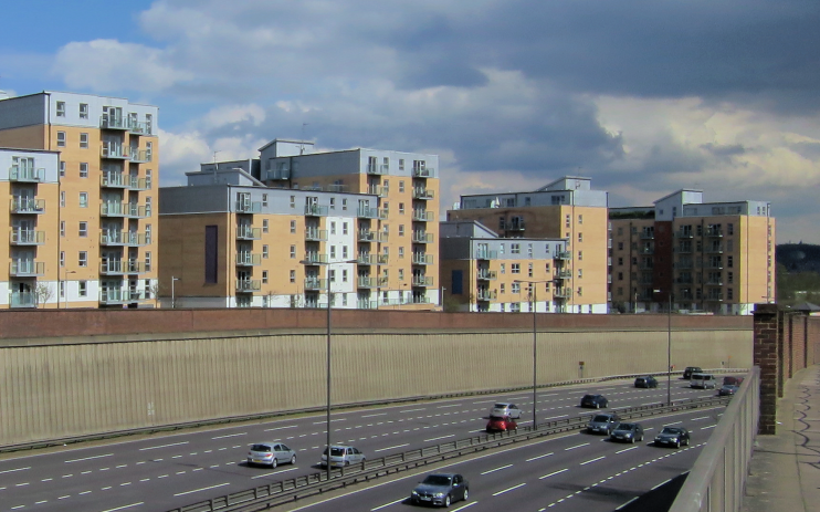
In 1969 three tower blocks were erected in the grounds of Elmhurst as halls of residence for Queen Mary College. The halls were sold for development in 2003 and the site has been rebuilt by Telford Homes with the private apartment blocks of Queen Mary’s Gate, shown in the photograph at the top of this article.*
South Woodford’s aspirational character is reflected in the restaurants and specialist shops on George Lane. A conservation area protects the area around the northern part of the High Road.
The majority of South Woodford’s residents are of white British origin, and a variety of other ethnic groups make up the remainder.
The crime writer Ruth Rendell was born in South Woodford, where her parents both worked as teachers.
