Copers Cope
Copers Cope, Bromley
A former farm and now an electoral ward taking in central, north-west and south-east Beckenham

Copers Cope’s name may be a corruption of ‘Cooper’s Copse’. Copers Cope House began life as a farmhouse, probably in the late 17th or early 18th century. The house still stands at the corner of Southend Road and Copers Cope Road, hidden behind trees and fencing. It is the most significant building of its age in Beckenham but its appearance was altered when it was enlarged in the 19th century.
Copers Cope Farm covered 250 acres and was acquired by Beckenham’s leading landowners, the Cator family, in 1783. The Cators first sought to build houses on the farm in 1813 but it was not until the 1860s that New Beckenham truly began to evolve here. As so often in what is now outer London, the coming of the railways was the stimulus to suburbanisation: Beckenham Junction station opened in 1857, followed by New Beckenham in 1864.
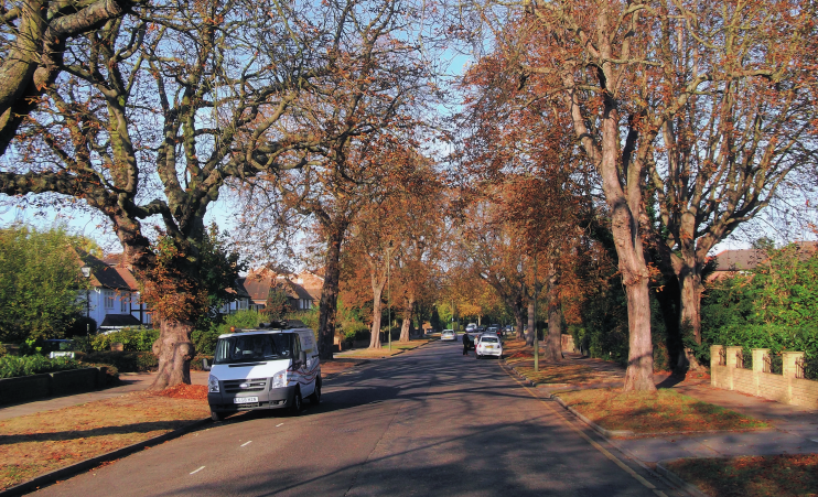
Most of the area was built up between the mid-1870s and mid-1890s. Lawn Road, Park Road (shown in the photograph above*) and Brackley Road were all named after former fields on Copers Cope Farm.
The presence of a cluster of sports grounds protected (and continues to protect) the north-western part from the density of housebuilding that occurred elsewehere. (The surviving grounds of Beckenham Place provided even better protection in the north-east, but this parkland lies outside the Copers Cope ward. See Beckenham Hill for more.)
In 2005 Beckenham MP Jacqui Lait raised the issue of local overdevelopment in a parliamentary debate, “with regard to more and more single family homes being torn down and replaced with apartment buildings,” and specifically mentioned the Copers Cope area.
As a result of the continuing conversions and replacements, the Copers Cope ward has a high proportion of one-person households and relatively few homes with dependent children. According to the 2011 census, 83 per cent of Copers Cope’s residents are white; down from 90 per cent in 2001.
Postcode area: Beckenham BR3
Population: 15,392 (2011 census)
Website: Copers Cope Area Residents’ Association – with an excellent page on the history of Copers Cope Farm
