Hill End
Hill End, Hillingdon
A hamlet and its outlying farms, situated north of Harefield, beyond the hospital

Although Hill End stands on relatively high ground, the name may derive from a former landowner rather than a topographical feature. However, if the name does refer to the latter, then the particular hill in question was probably One Tree Hill, which is located west of the hamlet, near the Canal Way development at the top of Summerhouse Lane.
There was a group of houses in what is now Hill End by 1754 and in the latter half of the 19th century a number of cheap cottages were built for workers who were toiling in the nearby chalk, gravel and sand pits and at the brickworks.
Quarrying and brickmaking are thirsty work and two pubs opened within a few doors of each other. The Vernon Arms was in existence by 1866 and it was joined by the Plough c.1890 – by which time the hamlet had made its first appearance on an Ordance Survey map, originally as Hillend.
Most of the present housing was built in the second half of the 20th century and is clustered across the road from an unexciting village green with a pond and a basically equipped playground. Nowadays a significant proportion of the hamlet’s population are residents of the purpose-built Harefield care home.
The Vernon Arms was sold by Courage in 1974 and used for residential purposes until around 1986, when the building was knocked down and replaced by four houses. Having spent its latter days as a children’s nursery (shown in the photo above*), the Plough was demolished at the end of 2015 and replaced by a terrace of three houses.
The area’s oldest surviving buildings are on Springwell Lane: Cripps Farmhouse (probably late 16th century, but much altered since) and the timber-framed barn to its immediate south-east. Click here for a bird’s eye view. The weatherboarded Cripps Farm Cottage was pulled down c.1950.
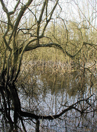
Farther up Springwell Lane the narrowboats strung along the canal draw the eye from the ramshackle workshops and the disused landfill facility at an old quarry.
According to 2011 census details for the Hill End output area the vast majority of residents are white British and more than two-thirds are homeowners.
The disused gravel and chalk pits around Springwell Lane have doubled as alien landscapes in several low-budget TV productions, notably early seasons of Dr Who.
Postcode area: Uxbridge UB9