Seven Kings
Seven Kings, Redbridge
A ‘people’s suburb’, as its developer described it, in eastern Ilford

This place probably began its existence as Seofecingas, meaning ‘settlement of Seofeca’s people’. Seofeca may (at best) have been a local Saxon chief.
In 1285† the spelling was rendered as Sevekyngges – and it must have been around this time that someone noticed a resemblance to the words ‘Seven Kings’. All subsequent appearances of the place’s name employed this folksy corruption, later embroidered with a whimsical story that its identity honoured an occasion when seven royal huntsmen paused here at a clearing in Hainault Forest, while their horses drank from a stream.
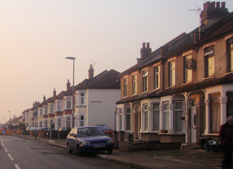
Seven Kings – or at least the part north of the High Road with the street plan that looks like an egg slicer – has been called “the town built in a year.” This was 1898–9, when local developer Cameron Corbett laid out an estate of good quality houses that clerks and lower grade civil servants could afford.

Because of its rapid growth and relative inaccessibility the new suburb was nicknamed Klondike by its first residents, but a station was quickly opened. With Corbett adding the Mayfield estate to the south and Downshall to the north, Seven Kings soon had 10,000 inhabitants.
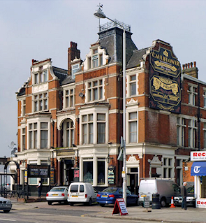
Shown in the photograph on the right,* the grade-II listed Cauliflower Hotel opened in 1900 on the site of an earlier public house. English Heritage describes it as “a good example of the opulent late-19th-century gin palace style with an imposing street presence … designed in a free Flemish/Jacobean style.”
The attractive Seven Kings bungalow estate of the 1920s and 1930s is now a conservation area.
In 1991 Redbridge council tried to convert Seven Kings Park into a new cemetery, but was dissuaded by a 10,000-signature petition.
Like neighbouring parts of Ilford, Seven Kings has become popular with Asian families. At the 2011 census 25 per cent of residents were of Indian heritage, 16 per cent white British, 14 per cent Pakistani, 9 per cent Bangladeshi, 5 per cent black African and 4 per cent black Caribbean. Three-quarters of homes here are owner-occupied.
At Tate Britain, the artist Michael Landy created a full-size replica of his parents’ house at 62 Kingswood Road, on the Seven Kings/Goodmayes border. The installation, entitled Semi-detached, was demolished after the six-month show in 2004.
Postcode area: Ilford, IG3
Population: 15,164 (2011 census, a 27 per cent increase on 2011)
Station: Elizabeth line (zone 4)
Further reading: Peter Foley, Seven Kings and Goodmayes: Origins and Early Development, Heptarchy [note the pun], 1993
