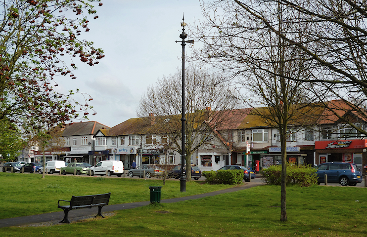
The Wrythe
The Wrythe, Sutton
A combination of council estate and conservation area situated at Carshalton’s northern cusp

The name was first recorded as ‘Rithe’ in 1229, and later misspelt as ‘Rye’. It did not gain an initial ‘W’ until the 19th century. A rithe was a small stream, usually one occasioned by heavy rain.
Gravel was extracted here from late medieval times. The area was subject to frequent flooding from an overflowing pond on the west side of Green Wrythe Lane and this may explain why there was so little habitation here for so long.
A cottage appeared and disappeared during the 17th century but the first enduring structure was a workhouse, built in 1792. Later named Leicester House, it went on to serve as a convalescent asylum and then as a succession of private schools. Beyond its grounds the Wrythe was common waste that stretched considerably further north than the green does today.
Improvements in drainage in the early 19th century brought the beginnings of a hamlet at Wrythe Green, which had two dozen dwellings by around 1850. A handful of houses survive from this era and now form the nucleus of the Wrythe Green conservation area. The disused Rosehill toll-house was rebuilt here around 1866 and given an extra floor and distinctive herringbone weatherboarding. It was renamed Bedford Cottage, later changed to Woodcote House.
A herb farm operated nearby until after the First World War. Leicester House was vacated in the 1930s and demolished after the Second World War owing to its neglected condition – but Woodcote House survived a similar threat and was restored.
The Durand Close council estate was popular with young families when it was built in the 1960s but suffered a decline and was afterwards the subject of a major regeneration programme.
The Wrythe’s residents are relatively poor by the borough’s standards and 83 per cent are white, according to the 2011 census.
The Salvation Army’s Carshalton Corps has its church hall on Green Wrythe Lane. In the 1880s the corps held noisy open-air prayer and hymn meetings on Wrythe Green until locals bombarded members with soot, flour and abuse.
