Slade Green
Slade Green, Bexley
The easternmost settlement in London south of the Thames, situated north of Barnes Cray
This was formerly the manor of Howbury, recorded simply as Hov in Domesday Book, from the Old English hōh, a heel of land. Slade Green was first mentioned in the 16th century, but the name is probably of earlier origin. A ‘slade’ was “a little dell or valley; or a flat piece of low, moist ground” and it was certainly the latter meaning that applied here.
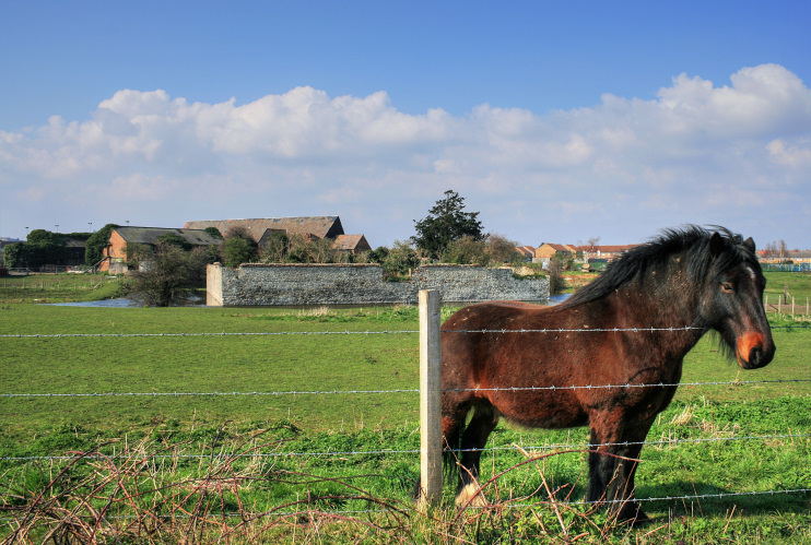
The ruins and moat of the house called Howbury constitute a scheduled ancient monument, and a Jacobean tithe barn survives, but in deteriorating condition. The structures are on private land and are not generally accessible to the public but can be seen from a nearby footpath, from which the photograph above was taken.
Howbury’s surroundings were fields on the edge of Crayford Marshes until industrial development began here in the late 19th century, mainly in the form of brickmaking and barge-building. The bulky church of St Augustine was built in 1900, and the station opened in the same year, followed by locomotive sheds and carriage sidings. The South East and Chatham Railway Company built a small estate of railway workers’ homes and a matching public house on Oak Road. The cottages are arranged in groups of four and designed to look at first glance as though each set is a single dwelling. Prolonged railway ownership kept the Oak Road estate relatively unspoilt and it is now a conservation area.
The council built flats, bungalows, semi-detached houses and shops in the late 1950s. The Corner Pin pub (1844) was demolished and rebuilt in 1958.
The system-built flats were demolished around 1990 and replaced by much more pleasant housing. Bellway Homes received permission to build homes off Slade Green Road in the mid-1990s in return for providing the Ray Lamb Way relief road. Barratts built the Watermead Park estate on reclaimed marshland later in the decade.
The former Slade Green secondary school now houses council offices. The area is well supplied with primary schools, including St Paul’s, Temple Grove and, to the west, Peareswood, each of which is part of a larger academy trust.
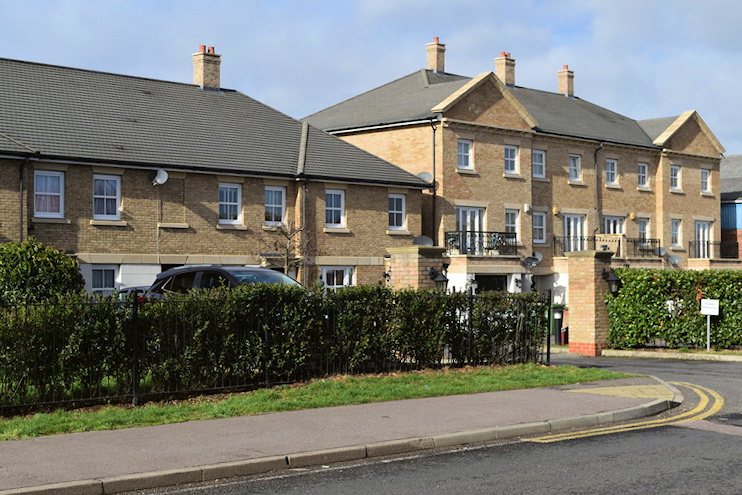
The locality’s former Howbury centre and its surroundings have been redeveloped as Ratio, with 372 homes “inspired by regency-style architecture” – plus the usual smattering of neighbourhood amenities associated with such schemes (although not as many as were originally promised). Unlike most major developments in modern London, Ratio includes a high proportion of three- and four-bedroom family houses, as well as the more predictable two-bedroom apartments.
A proposal to construct a huge distribution park adjacent to the rail lines south-east of the station appears to be in abeyance following the Mayor of London’s rejection of a revised planning application. However, the Howbury Park project may yet go ahead in some form as the site has been allocated for this purpose in the London Plan.
Postcode area: Erith DA8
Station: Southeastern Trains (zone 6)
Further reading: Edward Thomas, Slade Green and the Crayford Marshes, Bexley Local Studies and Archive Centre, 2001