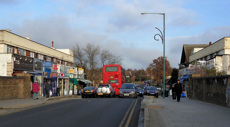
Burnt Oak
Burnt Oak, Barnet
A relatively deprived community located on the southern side of Edgware, dominated by the London County Council’s Watling estate

Evidence has been found of a Roman rubbish pit dating from around ad300. Most of the cultivated land here had been enclosed by the latter part of the 16th century.
A common field called Sheveshill lay near the site of the tube station and disappeared sometime around the 1830s, when a workhouse for 350 inmates was built at Redhill. A union school for 150 children was added in 1859 and houses went up in North, South, and East Roads soon afterwards, presumably to serve the workhouse. The workhouse infirmary has since evolved to become Edgware community hospital. A farmhouse was built to the south – and it still had a cow-keeper in 1922.
Burnt Oak remained predominantly rural until 1924 when the London Underground station opened and the London County Council bought land to build 4,000 homes. The first Tesco supermarket opened in 1929 in Burnt Oak, although founder Jack Cohen had already been selling groceries in the markets of east London for a decade.
The Watling estate was complete by 1930 and included good provision of green spaces but a variety of other amenities were not made available until later. Private companies then built on the estate’s perimeter, notably the Sheffield-based firm Henry Boot and Son, which developed the site of Burnt Oak Farm after 1930. Many residents found employment at the de Havilland aircraft works in Stag Lane (see also Queensbury).
Over the second half of the 20th century houses and flats replaced many commercial premises and the old Redhill hospital buildings.
On almost every index of deprivation, Burnt Oak ranks the highest in the borough and it is the most densely populated. As a consequence, Barnet council has targeted the locality for numerous regeneration efforts. The ward also has the borough’s highest proportion of disabled people and relatively large numbers of white Irish and eastern European residents, as well as those of Indian and African descent. At 33.7 years, the average age of Burnt Oak residents is relatively low, mainly because of the large number of households with children, including many single-parent households.
Postcode area: Edgware HA8
Population: 18,217 (2011 census)
Station: Northern line (zone 4)
