Harlington
Harlington, Hillingdon
A medieval manor and village transformed by later transport improvements, situated south of Hayes

This was Hygeredington in 831 and Hardington (or variations upon it) for several centuries after that.
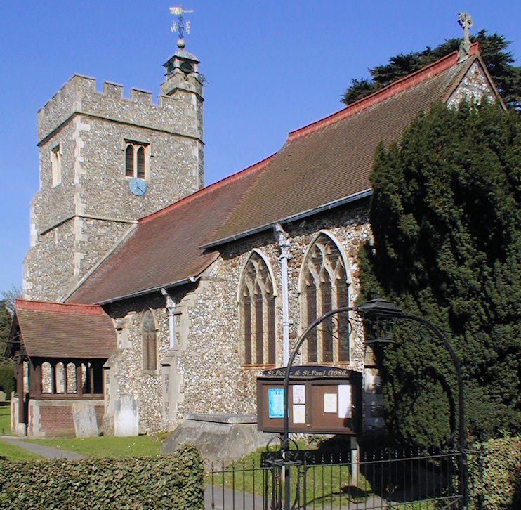
Shown in the photo above, the church of St Peter and St Paul was in existence by 1086, when the manor house stood nearby. The church’s Norman south door is said to be the best in outer London.
The centre of the village had shifted southward by the 17th century and a small settlement had grown up at the West End of Harlington by the 1750s.
To the north of the parish the Grand Junction (now Grand Union) Canal was constructed in the 1790s and the Great Western Railway was built through the district in the 1830s, although Hayes and Harlington station did not open until 1864. Cottages were built for brick-workers and new public houses joined the White Hart and the Red Lion.
The intensity of brickmaking and gravel-working in the north was so great that much of the land was lowered by several feet.
The presence of the railway and the canal brought factories to the Dawley area, and these in turn brought housing, especially semi-detached properties north of Pinkwell Lane in the 1930s, and some later council flats. This evolution consumed the former village of Pinkwell and merged with Hayes to the north – indeed, many consider this section to be part of Hayes rather than Harlington. The part of the parish that lay south of the Bath Road (A4) was taken by the air ministry in 1945 for the creation of what became Heathrow airport.
The construction of the M4 motorway in the 1960s divided the area into two quite distinct parts. The area north of the motorway is now entirely filled with housing, while the old centre to the south has been protected from overdevelopment, although much of the village had already lost its original character as a consequence of the proximity of Heathrow. Harlington village was made a conservation area in 2005.
At Harlington community school, on Pinkwell Lane, the roll is ethnically very diverse and has a very high proportion of pupils with English as an additional language, but only a small proportion is at the early stages of language acquisition.
Queens Park Rangers FC trains at Imperial College’s Harlington sports ground on Sipson Lane – and appears likely to be staying here for the foreseeable future, despite earlier plans to create a new training base at the Warren Farm sports centre, which is located between Hanwell and Southall.
Harlington Locomotive Society is a model engineering club that runs a miniature railway set in a small orchard. It’s usually open to the public on two Sundays each month from Easter until October.
