Nine Elms
Nine Elms, Wandsworth
A mixed-use riverside area situated between Battersea Park and Vauxhall, presently being redeveloped with a forest of upmarket apartment blocks

There was a IX Elmes Farm here in 1646 and agriculture continued to dominate the riverside landscape into the 19th century, with market gardens growing asparagus and other vegetables for the London markets.
In 1838 the London and Southampton Railway Company opened its terminus at Nine Elms. The line was extended to Waterloo in 1848 and Nine Elms became the site of a goods yard and locomotive works. A gasworks was built and in 1865 this was the scene of the largest explosion in 19th-century London – a million cubic feet of gas ignited and eleven men were killed in the blast.
The neighbouring housing was inevitably cramped and grimy and there was widespread poverty among the residents.
In 1914 the Women’s Freedom League established the pioneering Nine Elms Settlement in Everett Street, serving children with dinners of vegetarian soup and large slices of pudding, which they could either eat there or take home.
From 1933 Battersea power station was built on the western side of Nine Elms. Sir Giles Gilbert Scott’s structure has a steel girder frame and exterior brick cladding and is said to be the largest brick building in Europe. It was actually two power stations, the second of which was not built until 1953, when the third and fourth chimneys were added. Following a progressive run-down, the power station closed in 1983 and was thereafter repeatedly touted for conversion to some kind of major leisure destination, with a succession of investors failing to deliver on their extravagant promises for the renovation of the structure itself and enhancements to the surrounding area.
In 1974 Covent Garden’s flower market and fruit and vegetable market moved to Nine Elms, taking over the site of the north and south railway goods depots. New Covent Garden now has more than 200 businesses employing 2,500 people, and claims to supply 40 per cent of the fresh fruit and vegetables eaten outside of the home in London and to be used by three-quarters of London florists.

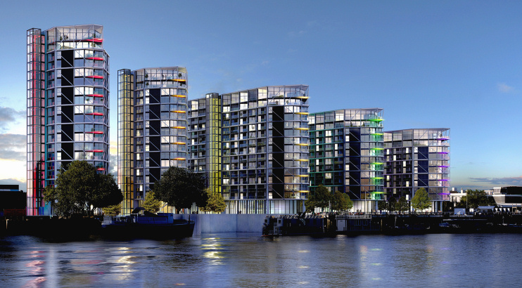
Waterside apartment complexes have recently added an upmarket residential aspect to Nine Elms, notably in the form of the six ‘pavilions’ of Riverlight (CGI shown above). Away from the shoreline, the area’s numerous depots and warehouses have been elbowed out to make room for pricy mixed-use projects.
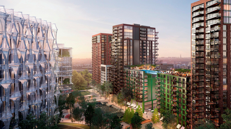
The most high-profile development is the new American embassy – which opened in January 2018 – and the surrounding Embassy Gardens estate, which is shown in the CGI at the the top of this article, with the embassy itself on the left. President Trump described Nine Elms as a “lousy” and “horrible” location for the embassy.

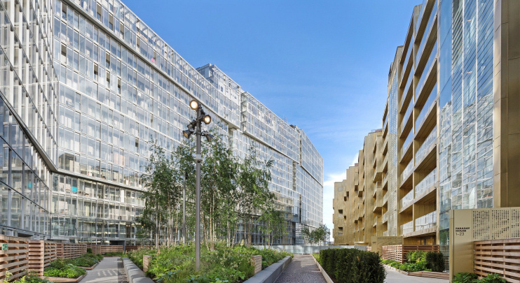
Despite the erstwhile desire of Chelsea football club to relocate here, Battersea power station has been redeveloped as a giant block of flats, tightly hemmed in by yet more blocks of offices, shops and homes, in a Malaysian-owned scheme that may not be completed until 2023. The £8 billion project will include a six-acre riverside park. Aspects of the development have been described in the Architects’ Journal as “grim, dire and dystopian” – but Faraday House, shown on the right in the CGI above, won a RIBA London Award in 2018.
Northern line stations opened at Nine Elms and Battersea Power Station on a new branch from Kennington in September 2021.
Battersea power station’s status as an iconic London landmark was bolstered in 1977 when the cover of Pink Floyd’s Animals featured a giant pig flying between its chimneys.
Postal district: SW8
Stations: Northern line (Nine Elms and Battersea Power Station, zone 2)
Website: Nine Elms on the South Bank
Twitter: Nine Elms London
Further reading: Colin Allen, Transplanting the Garden, Covent Garden Market Authority, 1998
