Shacklewell
Shacklewell, Hackney
A multi-ethnic neighbourhood with some light industry, almost squeezed out of acknowledged existence by Hackney, Dalston and Stoke Newington, which surround it

Shacklewell’s name may refer to a well-spring in a sunken place or where animals could be shackled (tethered) and was not recorded until 1490, despite its probable Old English origin.
In the early 16th century Sir John Heron, reputedly the richest man in Hackney, owned a large estate centred on a manor house here – its site now covered by shops. Several villas for gentlemen were built during the course of the 18th century, interspersed with lesser properties for tradesmen, two pubs and a dairy on the south side of the village green.
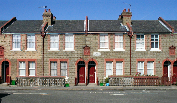
Side roads subsequently proliferated, many lined with cramped terraces, but Shacklewell remained an isolated settlement until Hackney expanded outwards to meet it in the mid-19th century. Perch, Seal and April Streets (the latter shown above) were laid out in the early 1880s with good quality terraces for working people, and Shacklewell Green was taken into public ownership.
By the early 20th century Shacklewell had gained a synagogue and some industrial premises, while a number of larger houses were being knocked down and replaced by more terraces.
The grade II* listed church of St Barnabas was built on Shacklewell Row in 1909-11. Its neo-Byzantine architecture (and later interior decoration) was the work of Charles Reilly, who had attended the church’s precursor, the Merchant Taylors’ school mission.
Parts of Shacklewell became a slum and several streets were cleared in the 1930s to make way for municipal and philanthropic housing projects. More flats followed after the Second World War.
The conversion of the synagogue to a Turkish mosque* is an indication of the shift in Shacklewell’s ethnic mix in recent decades. At Shacklewell primary school (which opened in 1951) over 80 per cent of children are from black, Indian, Pakistani, Bangladeshi, Turkish or Chinese backgrounds.
The Petchey Academy was built on the site of the former Kingsland secondary school (originally Dalston county school) in 2006 and has a sixth form ‘university gateway’ that opened in September 2011.
Shacklewell’s church is now home to a ‘planted congregation’ – consisting of ‘hipster Christians’, according to one source. No longer St Barnabas Shacklewell (perhaps not hip enough) it is now St Barnabas Dalston. Under the church’s aegis, the neighbouring mission hall hosts community events and activities. With its adventurous taste in live music, the Shacklewell Arms is almost as hip as the church – and also describes itself as being in Dalston.
