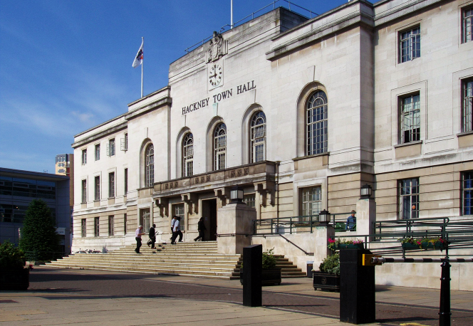
Hackney
Hackney, Hackney
Formerly ‘that Arcadia beyond Moorfields’ and now a multicultural, multi-social and multilingual district, situated three miles north-east of St Paul’s

Hackney probably takes its name from Haca, a Danish nobleman, and ‘ey’, an island, for the River Lea and its tributaries once dissected the area. The village had a church by 1275, when wealthy Londoners were already beginning to build country retreats here.
In the 16th and 17th centuries the large, rambling houses of Hackney’s aristocrats became a distinctive feature of the landscape. Samuel Pepys paid several visits to Hackney, “which I every day grow more and more in love with.”
By the 18th century Hackney’s wealth, which remained remarkable, no longer derived from the presence of noblemen but from merchants, including Huguenots and Jews. Church Street (now the northern part of Mare Street) was lined with shops and houses by the 1720s, which spread outwards over the next century, while the formerly separate hamlet of Mare Street expanded to meet it.
Hackney’s housing stock converged with that of its near neighbours at Homerton and Lower Clapton in the first quarter of the 19th century, when entrepreneurs began to actively exploit their leases in the area. Streets of substantial villas for the middle classes were laid out but the quality of building declined after the arrival of the railway in the 1850s, when larger old properties began to be demolished to make way for compact terraced housing. Private blocks of flats were built as early as the 1870s.
By the end of the 19th century Hackney was looking increasingly like part of the East End, although only London Fields, Homerton and outlying Hackney Wick suffered from widespread, entrenched poverty. Commerce thrived on Mare Street, where many of the shops were rebuilt on a grander scale and the Hackney Empire music hall opened in 1901. Soon after this, the London County Council built flats in London Fields and on Mare Street, initiating a process that would change the face of Hackney over the following decades.
Industrial growth reached a new level of intensity between the wars, as did municipal building, with the borough and county councils each providing thousands of new dwellings. The flat-building programme was repeated after the Second World War, especially on bomb sites. Tower blocks grew higher with each passing decade until the late 1970s, while industry declined. Thereafter, different conditions prevailed and the main trends were towards refurbishment of existing properties, the rebuilding of large estates on a less impersonal scale and a growing role for housing associations.
Afro-Caribbeans began to replace Jews as the predominant minority from the 1960s and were later joined by immigrants from Africa (who, together with their British-born offspring, now constitute Hackney’s largest sub-group after white British), south Asia and the eastern Mediterranean, making this one of London’s most ethnically diverse communities.
With varying veracity, several London districts that once had (or still have) a flawed reputation are nowadays touted as ‘hip’. It’s relatively true of Hackney.
Postal districts: E8 and E9
Population: 77,336 (Chatham, Hackney Central, Hackney Downs, Queensbridge, Victoria and Wick wards, 2011 census)
Station: London Overground (Hackney Central, zone 2)
Further reading: Iain Sinclair, Hackney, That Rose-Red Empire: A Confidential Report, Penguin, 2010
Website: The Hackney Society
