Wallington
Wallington, Sutton
An expanded linear suburb situated east of Carshalton

This place’s name was first recorded as Waletona c.1080 and Waletone in 1086 (Domesday Book) and derives from the same root as ‘Wales’, almost certainly denoting an early Celtic settlement – an enclave of Britons coexisting alongside Saxon settlers nearby.
Wallington’s status as a hundred – an extensive administrative area – indicates its medieval importance, as did the size of its Norman manor, but the village had become Beddington’s inferior by the late Middle Ages. It was part of Beddington parish but had a chapel that was outside the jurisdiction of the parish priest in the 16th century, with its own graveyard.
A paper mill was in existence in 1771, later grinding flour and ultimately making chocolate. The millpond survives as the Grange Lake, which is located right at the top of the map below. Early in the 19th century the hamlet consisted of just a few cottages and an inn, grouped around the village green, together with a handful of outlying houses.
The construction of the Croydon to Epsom railway in 1847 triggered lasting changes. The owner of the Carshalton Park estate forbade the building of a station on his land, so Carshalton station (now Wallington) was sited here, to the south of the village.
Nathaniel Bridges, lord of Wallington manor, began to lay out an estate of Gothic villas to the east of Manor Road in the early 1860s. Bridges sponsored the construction of Holy Trinity church and Wallington became a separate parish from Beddington in 1867.
Now located in the far south of the district, Wallington high school for girls opened on Manor Road in 1896, having outgrown the Carshalton home of its predecessor, the catchily named Church high school of Carshalton, Wallington, Beddington and Sutton (St Barnabas).
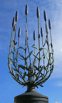
Wallington’s development was not rapid but by the 1910s the growing town was expanding across the former lavender fields and a new centre had taken shape along Woodcote Road to the south of the station.
Wallington was the larger partner in its 1915 pairing with Beddington as an urban district, and it subsequently absorbed Bandon Hill and South Beddington.
Wallington county grammar school – as it is now called – opened in 1927 and moved to its present site on Croydon Road in 1935.
Between the world wars many of the largest early-Victorian properties were replaced by smaller homes, and a town hall and library were built on and behind Woodcote Road. Other houses on the Bridges estate were replaced by flats after the Second World War.
Shown in the photograph at the top of the page,* the town hall later became a crown court and is now a Sutton College centre.
Following the creation of Wallington Square in the 1960s the vicinity of the station became the borough’s second most significant commercial zone, after Sutton itself, with several office blocks and a shopping centre. This subsequently faced some of the difficulties common to almost all secondary retail destinations and is presently undergoing a phased programme of regeneration that includes the construction of blocks of low-rise flats.
At the 2011 census 73 per cent of Wallington’s residents were white British (down from 85 per cent in 2001). More than 70 per cent of homes here are owner-occupied.
The writer and artist Mervyn Peake lived in Wallington as a young man in the 1920s and again in the 1950s, after his father died and bequeathed his house to him.
The rock guitarist Jeff Beck was born in Wallington in 1944.
Postcode area: Wallington SM6
Population: 20,850 (Wallington North and South wards, 2011 census)
Station: Southern (zone 5)
Further reading: John Phillips et al, Carshalton, Wallington and Beddington, Tempus, 1995