Colliers Wood
Colliers Wood, Merton
A former industrial village now hemmed in by Merton and Tooting Graveney

Colliers Wood was first recorded in 1632 and the name refers to charcoal-burners not miners (as is also the case with Collier Row, across the other side of London).
From 1755 a tollgate stood on the Merton Road (now High Street Colliers Wood) on the site of the present station, which gave rise to the alternative village name of Singlegate. Colliers Wood House, which had been home to Elizabethan and later notables, was rebuilt around 1780.
By the early 19th century mills beside the River Wandle were switching from grinding corn to printing textiles, an industry that soon employed the bulk of the local labour force. In 1851 only a twentieth of the population worked in agriculture, a remarkably low proportion for such an out-of-the-way place.
In the 1870s the 40-acre grounds of Colliers Wood House began to succumb to speculative building, at first in the direction of Tooting, then towards Merton. The tollgate was taken down and the first shops, a school and Christ Church were built. Colliers Wood House was demolished in 1904; its site is now occupied by the low numbers of Clive Road and Warren Road.

A tram service began in 1907 and streets of terraced houses were laid out on land belonging to Emmanuel College, Cambridge.
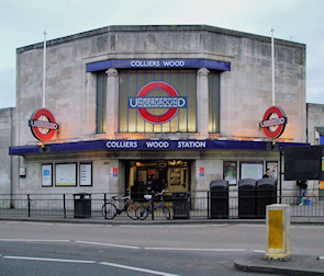
Builders squeezed in a last few pebble-dashed and mock-Tudor properties after the Northern line (as it is now called) was extended here in 1926. The station was designed by Charles Holden, whose name now adorns the pub opposite.
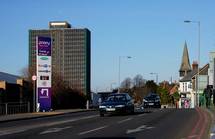
Subsequent additions included council flats, a 19-storey office tower and a Savacentre that was said to be the largest hypermarket in Europe and has since been divided into a Sainsbury’s and a Marks and Spencer (located near the bottom left corner of the map below).
Colliers Wood saw a flurry of housebuilding in the early 21st century, partly because Tooting’s growing popularity increased the desirability of neighbouring, more affordable localities.
After standing empty for several years, the widely derided tower is likely to be given a facelift and converted to residential use, possibly accompanied by a new, slightly shorter block next door.
At the 2011 census 38 per cent of Colliers Wood’s residents were white British and 18 per cent were of South Asian heritage. A relatively high proportion of residents are in their twenties and living in privately rented accommodation.
Postal district: SW19
Population: 10,712 (2011 census)
Station: Northern line (zone 3)
Websites: Colliers Wood Residents’ Association, Making Colliers Wood Happy
