Hacton
Hacton, Havering
An unprepossessing rural hamlet and a housing estate to its north, situated between Hornchurch and Corbets Tey

In Place Names of Greater London, John Field suggests that the name Hacton meant ‘farm on a hook-shaped piece of land’, pointing out that the hamlet is “on the tongue of land formed by the junction of the Ingrebourne and a tributary.”
Hacton Bridge was in existence by 1299. In the 1660s the wooden crossing was reinforced so that it could bear the weight of horse-drawn carts carrying corn to Romford market. The first brick bridge was built in 1728.
According to the Victoria County History of Essex, the Cock at Hacton was the earliest known inn in the parish of Upminster – but it had closed by 1769.
Marked with a big pink pin on the map below, Hacton House (originally Hactons) was built around 1770 for a London merchant. The house survives to the present day but has been much messed about with in the process of its conversion to multiple dwellings. (Click here for a Bing bird’s eye view.)
South of Hacton House, 19th-century rural depopulation led to the loss of the cottages that once lined Hacton Lane. The hamlet of Hacton consists now of a handful of houses at the junction of Hacton Lane with Berwick Pond Road and Park Farm Road. The White Hart, which had been created out of two labourers’ cottages in 1854, was converted back into a private residence in 2012.
The hamlet’s immediate surroundings are flat farmland, though the chimneys and pylons of industrial east London loom on the horizon. Hacton Park Corner Farm has a 300-year-old barn but the late-16th-century farmhouse was bombed out of existence in the Second World War. The 42-acre farm became an equestrian centre in 1995.
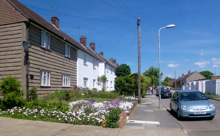
North-west of the River Ingrebourne, Hornchurch council built 548 homes in the years immediately before and after the Second World War on what had been Hacton Farm. Most of the streets on what is nowadays known as the Hacton Lane estate are named after racecourses. The photograph at the top of this article shows Newmarket Way.* Hacton school opened on Chepstow Avenue in 1948 and is now a community primary school catering for children aged 3–11.
Near Hacton House, at a corner of the Upminster–Hornchurch suburban sprawl, the Optimist tavern opened in 1956.
Residents of Hacton ward are overwhelmingly white British, relatively likely to have an administrative or secretarial job and relatively unlikely to possess higher level educational qualifications.
Hacton Parkway is a part of the Green Chain walk beside the River Ingrebourne.
