Hounslow
Hounslow, Hounslow
A major commercial centre and a predominantly Asian residential district situated east of Heathrow airport

Hounslow was first mentioned in Domesday Book and the name is a corruption of Old English words meaning ‘hound’s mound’. The mound may have been a burial tumulus but is not known whether the ‘hound’ element referred to the animal or a man of that name or nickname.
A Trinitarian friary was established around 1200, in the vicinity of the present-day police station on Montague Road. At the time of the dissolution of the monasteries, the friary was the richest Trinitarian house in England. The friary’s chapel subsequently evolved into Holy Trinity church.
By 1635 Hounslow had already acquired significance as a coaching halt, conveniently located just before the Bath and Staines roads diverged across Hounslow Heath. Although the village barely extended beyond the High Street, there were over a hundred residents and at least five inns, some of which had been in existence for more than a century. The separate village of Lampton lay to the north.
In the 18th and early 19th centuries Hounslow was the first stop outside London for nearly all the westbound coaches; in 1833 over 200 coaches passed through every day. Hounslow station opened in 1850 on a loop of the Windsor, Staines and South Western Railway and within a decade new roads were being laid out for suburban housebuilding. Development was slow at first and accelerated only moderately after the arrival of the Metropolitan District Railway in the 1880s.
In the early years of the 20th century the area around the High Street evolved into a proper town centre, and civic offices, a library and public baths were built on Treaty Road. Hounslow grew rapidly after the First World War, absorbing Lampton and Maswell Park and creating the new district of Hounslow West.

After the Second World War, council housing erased the last remaining fields, notably at Beavers Farm. Holy Trinity church was destroyed by arson and rebuilt in 1961.
The High Street was progressively redeveloped from the 1960s onwards, with office blocks as well as shops. At this time large numbers of south Asian immigrants began to settle in the area, at first because it was close to their point of arrival at Heathrow Airport, and then as a result of a snowball effect. Nowadays, most of Hounslow’s residents are of Asian heritage. More than 60 per cent of these Asian/Asian British residents are of Indian origin or descent.
In the mid-1980s the shops and new library of the Treaty Centre replaced the civic buildings of Treaty Road.
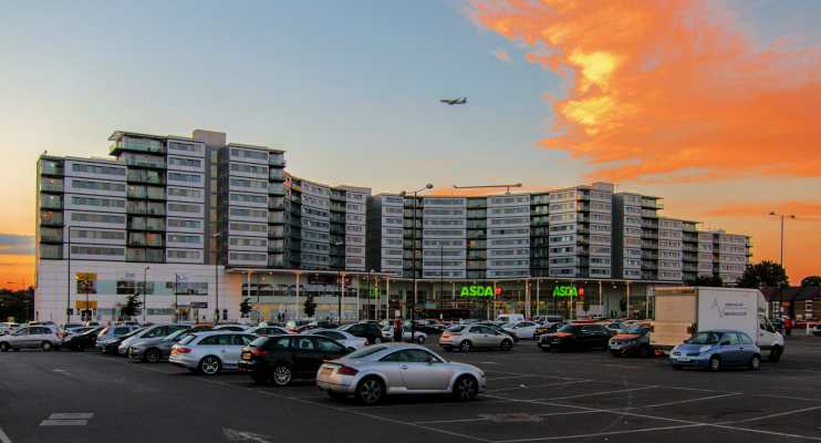
In a continuing process of change, the apartments and commercial premises of the Blenheim Centre (shown in the photo at the top of this article*) opened in 2006, and the mixed-use Hounslow High Street Quarter will add a new public square, a 27-storey residential tower and a multiplex cinema, with the final residential completions expected in late summer 2020.
The heroine of the 2002 British movie Bend It Like Beckham plays football for the fictional Hounslow Harriers.
