Temple Mills
Temple Mills, Newham/Waltham Forest
A former industrial, commercial and railway area beside the River Lea that was transformed for the 2012 Olympic Games

A crossing point on the River Lea brought early human activity to this locality and evidence has been found of a Roman camp nearby.
In 1185 William of Hastings, steward to Henry II, granted land here to the Knights Templar, who later built wooden watermills. After the dissolution of the order in the 14th century their property passed through a variety of hands (including the Crown’s) and milling and related agricultural industries continued to grow. The name Tempylmylle was first recorded in 1461.
A White Hart tavern stood at Temple Mills from the early 18th century.
In the latter part of the 19th century the mills were demolished and the Great Eastern wagon works were moved northwards from Stratford, with marshalling yards spreading inexorably. The works were modernised in 1958 as part of a programme that made them the largest in Britain. British Rail later added a Freightliner terminal.
The wagon works closed in 1983 and railway utilities progressively vacated other parts of the site over the following few years.
The Corporation of London relocated Spitalfields market to a site north of Ruckholt Road in 1991 and the A12 East Cross Route was constructed across Temple Mills later in that decade.
In 2007 Eurostar’s Temple Mills depot and engineeering centre opened on a site immediately north of New Spitalfields Market.
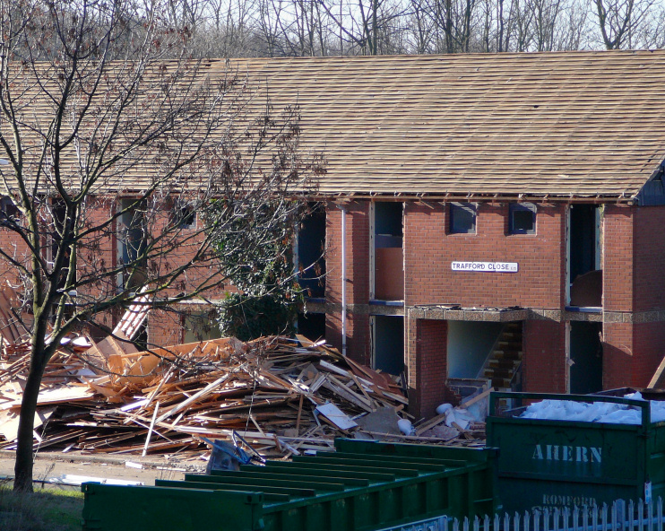
A swathe of Temple Mills was scarred by construction work on the Channel Tunnel rail link and the entire southern half of the locality was then transformed for the 2012 Olympic Games. Derelict land was reclaimed, factories and warehouses were flattened, as were social housing, a travellers’ site and students’ accommodation in the surprisingly hilly area around Clays Lane – a road now erased from the face of the earth. The photo above, taken in February 2007, shows the demolition of houses on Trafford Close in advance of the Olympics.
Most of the area once occupied by the Temple Mills wagon works, sidings and goods sheds has now metamorphosed into East Village, with Westfield Stratford City to the south and Stratford International station between the two.
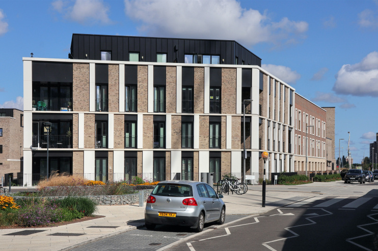
North-west of East Village a ‘vibrant new community’ called Chobham Manor has recently taken shape. The photograph below shows apartments at Ruckholt House, on the corner of Villiers Gardens and Derny Avenue. Beyond Chobham Manor, Olympic facilities for cycling, hockey and tennis have been retained.
Postal districts: E10, E15 and E20