West Barnes
West Barnes, Merton
An electoral ward and an indistinct locality that is part Raynes Park, part Motspur Park and part New Malden

The history and the identity of West Barnes are entangled with that of Raynes Park, for the latter was built almost entirely on the site of the former. In the 14th and 15th centuries Merton Priory owned two sets of barns where the produce of its estates was stored. West Barns (or West Barnes) Farm stretched from Merton Common to the Beverley Brook.
The farm was sold after the dissolution of the monasteries and in the early 17th century the land was divided between two brothers, creating Park House Farm and Moat Farm. Richard Garth, lord of the manor of Morden, acquired Park House Farm in 1867 and slowly developed it as Raynes Park.
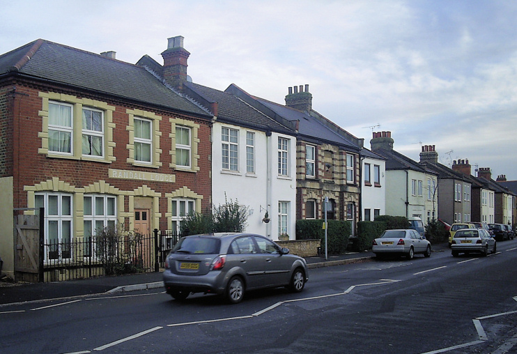
The buildings of West Barnes Farm stood at the south-east corner of what is now Raynes Park high school. Across the road, the first terrace of houses was built in the 1890s and the new settlement expanded southwards in the early years of the 20th century. To the east, houses went up at intervals (of time and space) along Grand Drive – including Bijou Villas, which are shown in the photograph above.*
Holy Cross church was built at the corner of Douglas and Adela Avenues in 1908.
Commerce flourished in the north-west corner of West Barnes. From 1919 the security printers Bradbury & Wilkinson operated from premises on Burlington Road, producing stamps, bonds, chequebooks and currency for countries throughout the world. The printworks has since disappeared beneath a Tesco Extra car park. (And beneath that car park is a floodwater holding tank – a beneficial facility in this low-lying spot between the Beverley and Pyl Brooks.)
Moat Farm survived until the 1920s when it broken up by the construction of the Kingston bypass and Bushey Road. A station opened at the southern tip of West Barnes in 1925 – and the decision to name it Motspur Park determined the future identity of its vicinity.
In the early 1930s Sydney Edward Parkes’s company, Modern Homes and Estates, bought land between West Barnes Lane and the railway line, building mock-Tudor homes with a government subsidy. Phyllis Avenue and Arthur Road are named after Parkes’s children. Another builder, William Palmer, named Estella Avenue for his daughter.
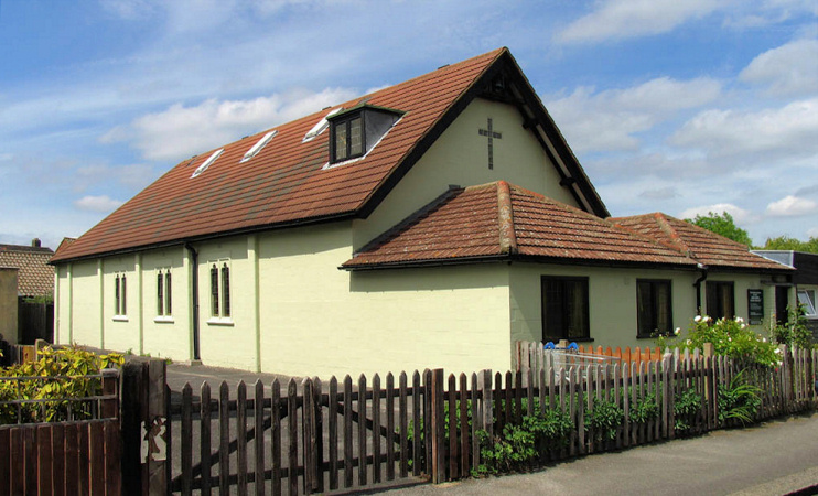
Following extensive war damage, Holy Cross was rebuilt in 1948, as shown in the photo below. The church halls were demolished and a new hall was constructed c.1970.

The majority of residents of the West Barnes ward are white British – and Christian. West Barnes library reflects some of the area’s key minority communities by maintaining collections of books in the Korean and Tamil languages. The ward has a high level of owner occupation and relatively few one-person households. The top three occupations here are: teaching and educational professionals, sales assistants and retail cashiers, and business, research and administrative professionals.
