Bowes Park
Bowes Park, Haringey/Enfield
A mixture of Victorian and interwar terraced housing, situated between Wood Green and Palmers Green

Bowes was a Norman manor and the name may derive from John de Arcubus – meaning ‘John of the bows’ – who owned land here in 1274. In 1412 Henry IV granted the manor to the dean and chapter of St Paul’s Cathedral. Bowes manor house lay to the north-east, near the present Sidney Avenue, and became noted for its landscaped gardens.
The 370-acre Bowes Farm estate, much of which was woodland, survived until the end of the 18th century. Thereafter, the Ecclesiastical Commissioners, who had succeeded St Paul’s as the landowners, began to lease plots of land for the building of large houses.
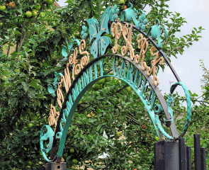
In the late 1850s the New River was realigned to remove two of its loops, which necessitated the construction of a tunnel here – using three and a half million London stock bricks. The tunnel entrance, located immediately north of Myddleton Road, is grade II listed. On the other side of the road a community garden has since been laid out above the ‘river’.
The Great Northern Railway Company constructed a branch line from Wood Green to Enfield in 1871 and opened Bowes Park station nine years later.
Designed in Gothic Revival style by Sir Gilbert Scott and mostly paid for by Alderman Thomas Sidney of Bowes Manor, the church of St Michael-at-Bowes was built in 1872–4 at the corner of Palmerston and Whittington Roads.
Sidney was also was also responsible for the area’s nascent suburban evolution, and the process accelerated after his death in March 1889.
St Michael’s national school (now St Michael at Bowes CofE junior school) opened on Tottenhall Road in 1896.
The United Reformed church of St James-at-Bowes was built in 1901–9 at the corner of Arcadian Gardens and the High Road, Wood Green. This grade II listed Art Noveau building is now the New Testament Church of God’s Cathedral of Praise.
“Bowes Park is Wood Green in its Sunday clothes,” wrote Thomas Burke (of Limehouse Nights fame) in The Outer Circle: Rambles in Remote London (1921), adding that Palmers Green is a Bowes Park that has “got on”. By this he seems to have meant that Bowes Park was classier than Wood Green – but not by much. Here the residents exhibited “the sedate pride of the humble, of those who will make the best of themselves and their possessions, while knowing them not to be of prime quality.”
Another phase of housebuilding filled the remaining gaps in the 1930s and 1940s, mainly with bay-fronted semi-detached and terraced houses. Most of Bowes Park’s public amenities were added during this period.
St Michael’s school was rebuilt in 1970–2. Around this time private firms replaced some of Bowes Park’s large Victorian houses with blocks of flats.
The dilapidated St Michael-at-Bowes church closed in 1986. Within two years it had been demolished and replaced by the present church and an adjacent hall. Several features of the old church were reinstated in the new one.
The western section of Myddleton Road is lined with shops and service providers, several of which reflect the presence of a Cypriot community here in the hinterland of Green Lanes.
Bowes Park has suffered difficulties with anti-social behaviour but a combined council and community initiative, begun in 1996, succeeded in reducing some of the problems and improving the look of the area.
In Enfield’s Bowes ward, 15 per cent of residents are Muslims and 6 per cent are Hindus, according to the 2011 census.