Haverstock Hill
Haverstock Hill, Camden
A former artists’ retreat and ‘metropolitan suburb’, now a section of the A502 linking Chalk Farm with Belsize Park

The road called Haverstock Hill runs for just under a mile north-westwards from Chalk Farm towards Hampstead. Chalk Farm Road becomes Haverstock Hill at the junction with Regents Park Road and Crogsland Road, and Haverstock Hill becomes Rosslyn Hill at at the junction with Belsize Lane. The southern end of the road is about 32 metres (105 feet) above sea level. It rises to around 77 metres (253 feet) by the time it becomes Rosslyn Hill.
First recorded in 1741, Haverstock Hill’s name is of uncertain origin. David Mills, in his Dictionary of London Place Names, speculates that it may be connected with a landowning family from Stock, near Chelmsford in Essex, which was called Haverstocke in the 17th century. Another suggestion is that the name referred to a place where oats were grown, but it is not clear (at least to Hidden London) how any variation on the word ‘Haverstock’ could have connoted oat cultivation. Either way, the name originally applied to the whole slope (and later to a hamlet on that slope) rather than the road, which was earlier simply called the Hampstead Road or the London Road.
Until the mid-19th century the hamlet of Haverstock Hill consisted of just the Load of Hay tavern (rebuilt in Italianate style in 1863 and now the Haverstock Tavern) and a few cottages lying below the corner of England’s Lane. An early resident was the writer Richard Steele, co-founder of both Tatler and The Spectator.
In 1847 the Orphan Working School moved from City Road to a 13-acre site that was named Maitland Park in honour of Ebenezer Maitland, the school’s late president. It was located on the west side of the newly built road named Maitland Park Villas. Later called the Royal Alexandra School, the institution relocated to Reigate, Surrey, after the Second World War.
The Anglican parish church of St Andrew, Haverstock Hill, was built in 1864–6 on Malden Road, which is now considered part of Kentish Town. The church was wrecked in the Blitz and demolished in 1955.
St Dominic’s Priory was built on Southampton Road in 1863–8 and its church was completed in 1883. The architects were Gilbert Blount and Charles Alban Buckler. From the outset, the priory complex included a school, which has evolved into the present St Dominic’s Catholic primary school.
Haverstock Hill railway station opened on the Midland Railway’s line into St Pancras in 1868. The station was located on the west side of Lismore Circus in Gospel Oak – at the top right corner of the map below. It was closed on New Year’s Day 1916 as a wartime economy measure – and never reopened.
The establishment of schools, churches, almshouses and other institutions on the hillside briefly made Haverstock Hill a more significant place (not just a road) than anywhere else between Camden Town and Hampstead. John Marius Wilson’s Imperial Gazetteer of England and Wales called it “a metropolitan suburb … [that] has undergone much recent extension” in 1872. In that same year, artists’ studios replaced the hamlet’s original cottages.

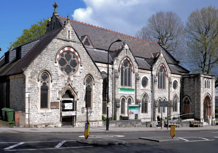
In 1877 the Oxendon Presbyterian church relocated from Oxendon Street in the West End to a new building on Haverstock Hill, designed by Thomas Arnold. Shown in the photo above,* the church was sold in 1970 to the Hampstead Seventh-Day Adventists.
The various estates bordering Haverstock Hill were sold off for development in the latter part of the 19th century. A vestry hall built in 1878 was later extended to become Hampstead town hall.
Belsize Park tube station opened in 1907, on what was then the Charing Cross, Euston & Hampstead Railway.
Phases of infilling and rebuilding have since wrought significant changes, notably in the 1930s and 1970s. The upper section of Haverstock Hill has become Belsize Park’s high street, where “the wide pavements with trees and benches and space for café tables give this area a distinctive continental character,” according to Camden council. The amenities here include the Everyman cinema (formerly the Screen on the Hill) and Wac Arts’ courses and community-based projects at the old town hall.
In recent years there have been attempts to foist the name ‘Steele’s Village’ (with or without an apostrophe) on the pleasant vicinity of Haverstock Hill’s junctions with England’s Lane and Steele’s Road. This is precisely the site of the original hamlet of Haverstock Hill and the merits of this rebranding are not obvious to Hidden London.
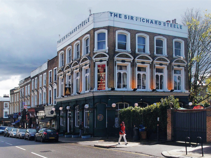
In May 2016 a judge ruled that the whole of the Sir Richard Steele – a Victorian pub located just across the road from the Haverstock Tavern and shown in the photo at the top of this article – is an asset of community value and as such should be protected from redevelopment.
George Clausen’s Spring Morning, Haverstock Hill (1881) is considered a definitive image of Victorian Britain. The painting, which hangs in Bury art museum, is especially notable for its portrayal of the contrasting economic circumstances of its subjects.
